Storm tide data and tide predictions for Tweed Sand Bypass Jetty monitoring site
Lowest Astronomical Tide datum (LAT)

Tides in this plot are reduced to Lowest Astronomical Tide datum (LAT)
Note that Lowest Astronomical Tide (LAT) datum is the lowest tide level which can be predicted to occur under average meteorological conditions and under any combination of astronomical conditions. Although this level may not be reached every year, it is not the extreme lower-level that can be reached, as storm surges or other meteorological events may cause considerably lower levels to occur.
Australian Height Datum (AHD)
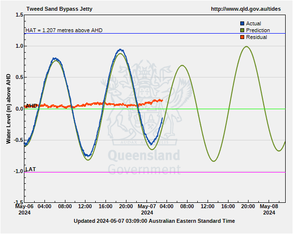
Note that Australian Height Datum (AHD) is the value adopted by the National Mapping Council of Australia as the datum to which all vertical control for mapping in Australia is to be referred. AHD approximates mean sea level and could be considered as a still water level if there were no tides or meteorological events affecting water levels.
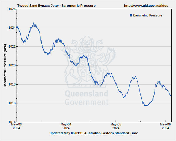
Barometric pressure
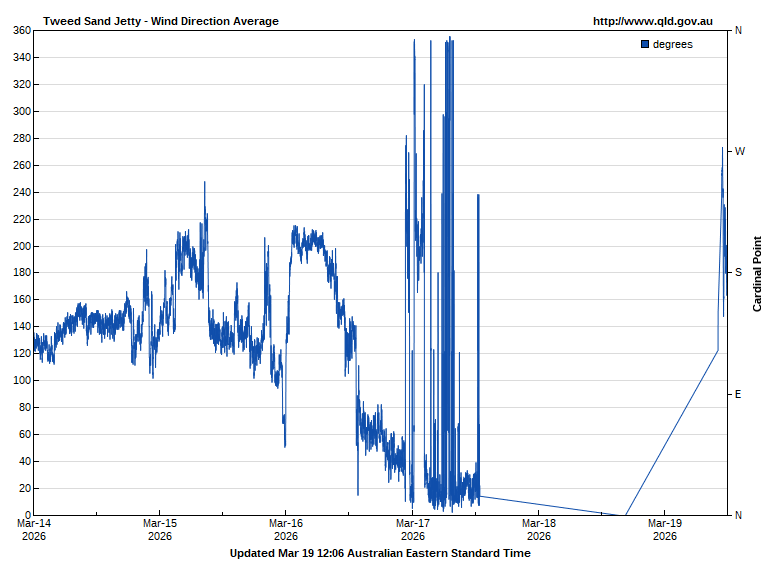
Wind Direction
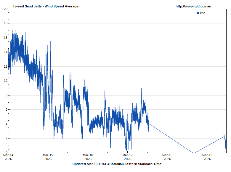
Wind Speed
Air temperature
Rainfall
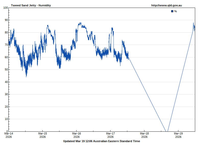
Humidity
While reasonable care and attention has been exercised in the collection and processing of the weather data it must be treated as unverified.
![[Open Data]](https://www.data.qld.gov.au/base/images/od_80x15_blue.png)