Maps and statistical data by catchment
Catchment analysis of remnant vegetation by regional ecosystem vegetation communities between 1997 and 2021 showing analysis of regional ecosystems by catchment.
- Remnant cover by catchment 69.4 KB)
- Regional ecosystems by catchment 5 MB)
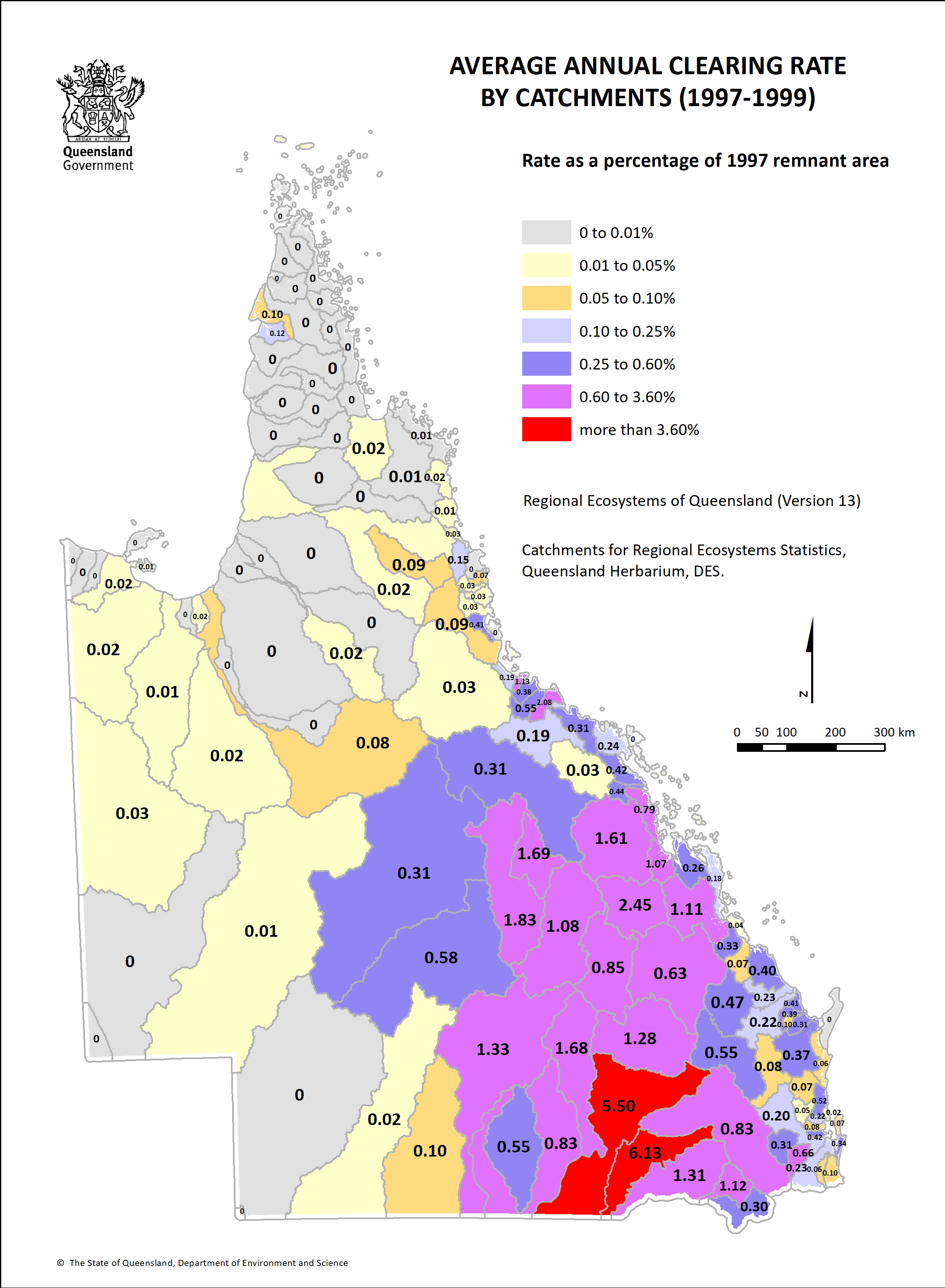
- Catchment clearing rate 1997-1999 1.3 MB)
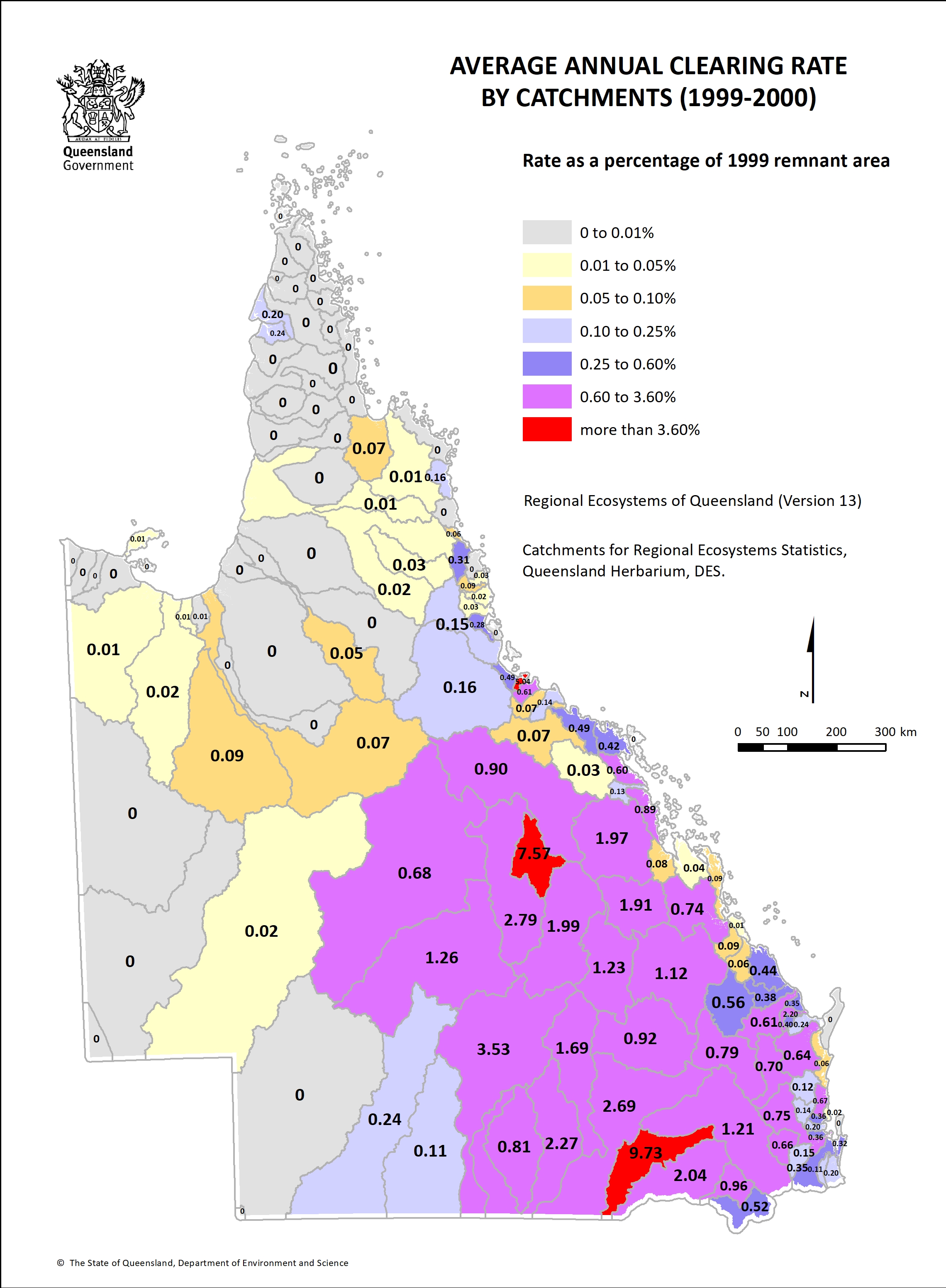
- Catchment clearing rate 1999-2000 1.3 MB)
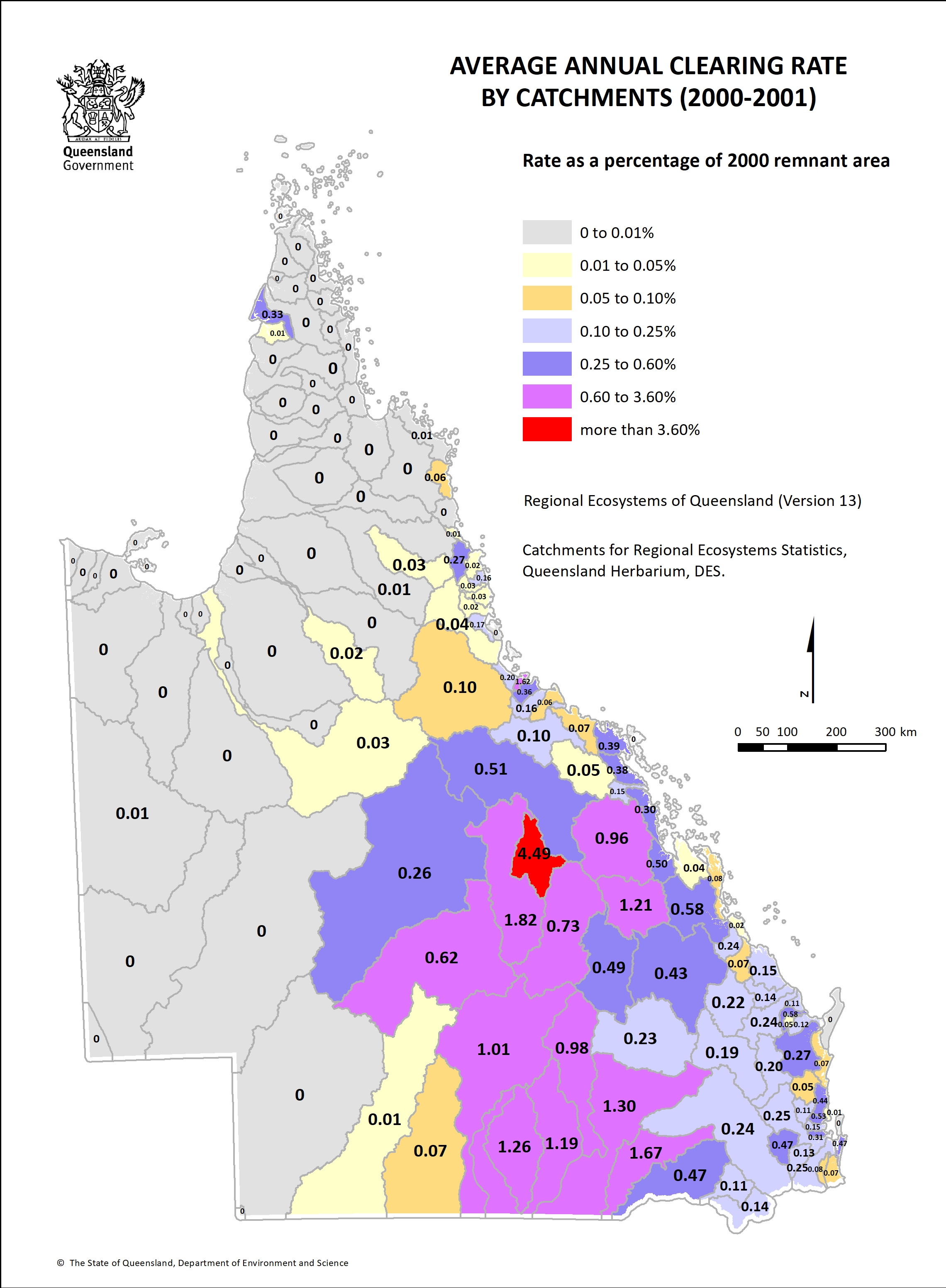
- Catchment clearing rate 2000-01 1.2 MB)
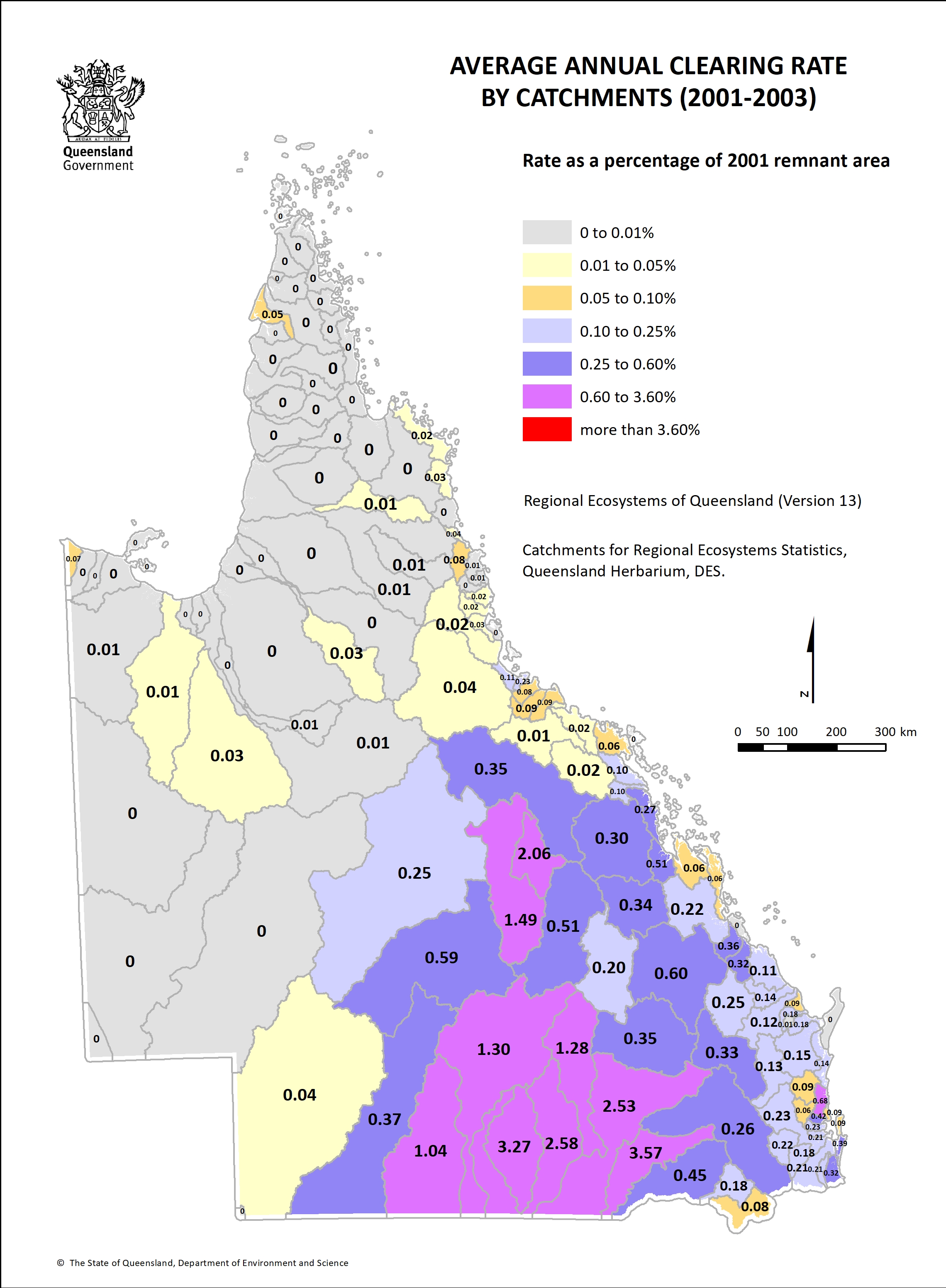
- Catchment clearing rate 2001-03 1.3 MB)
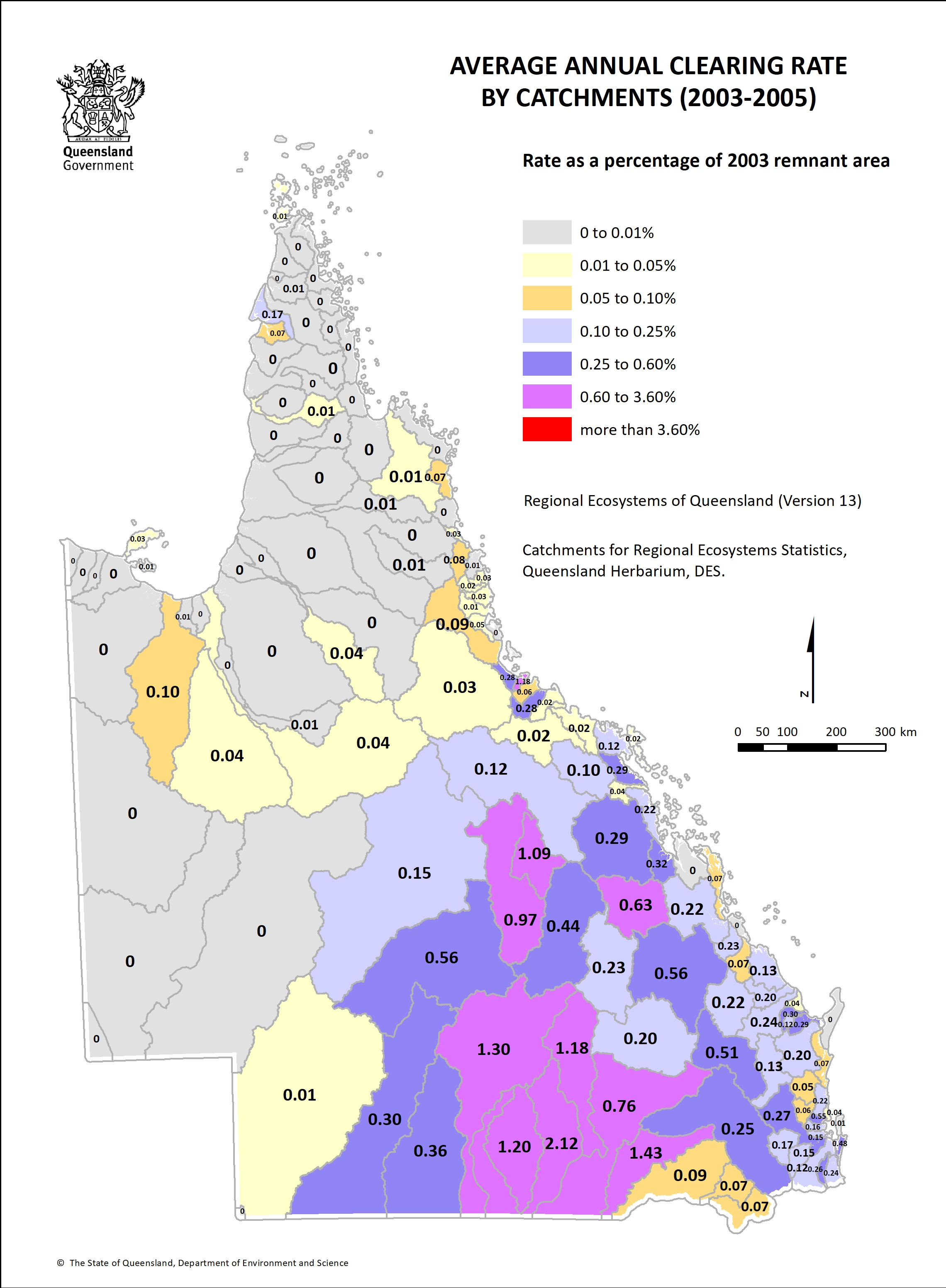
- Catchment clearing rate 2003-05 1.3 MB)
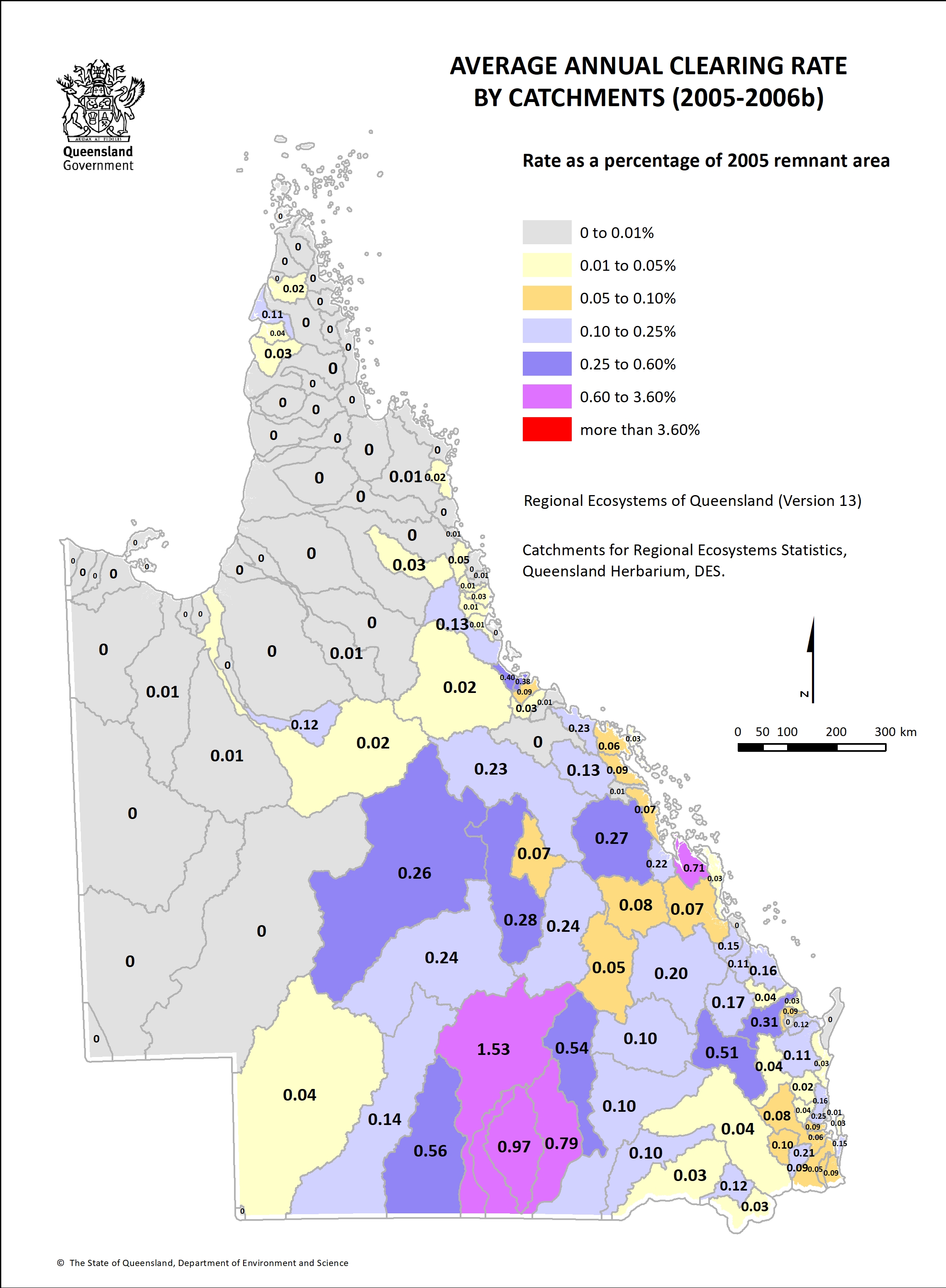
- Catchment clearing rate 2005-06b 1.2 MB)
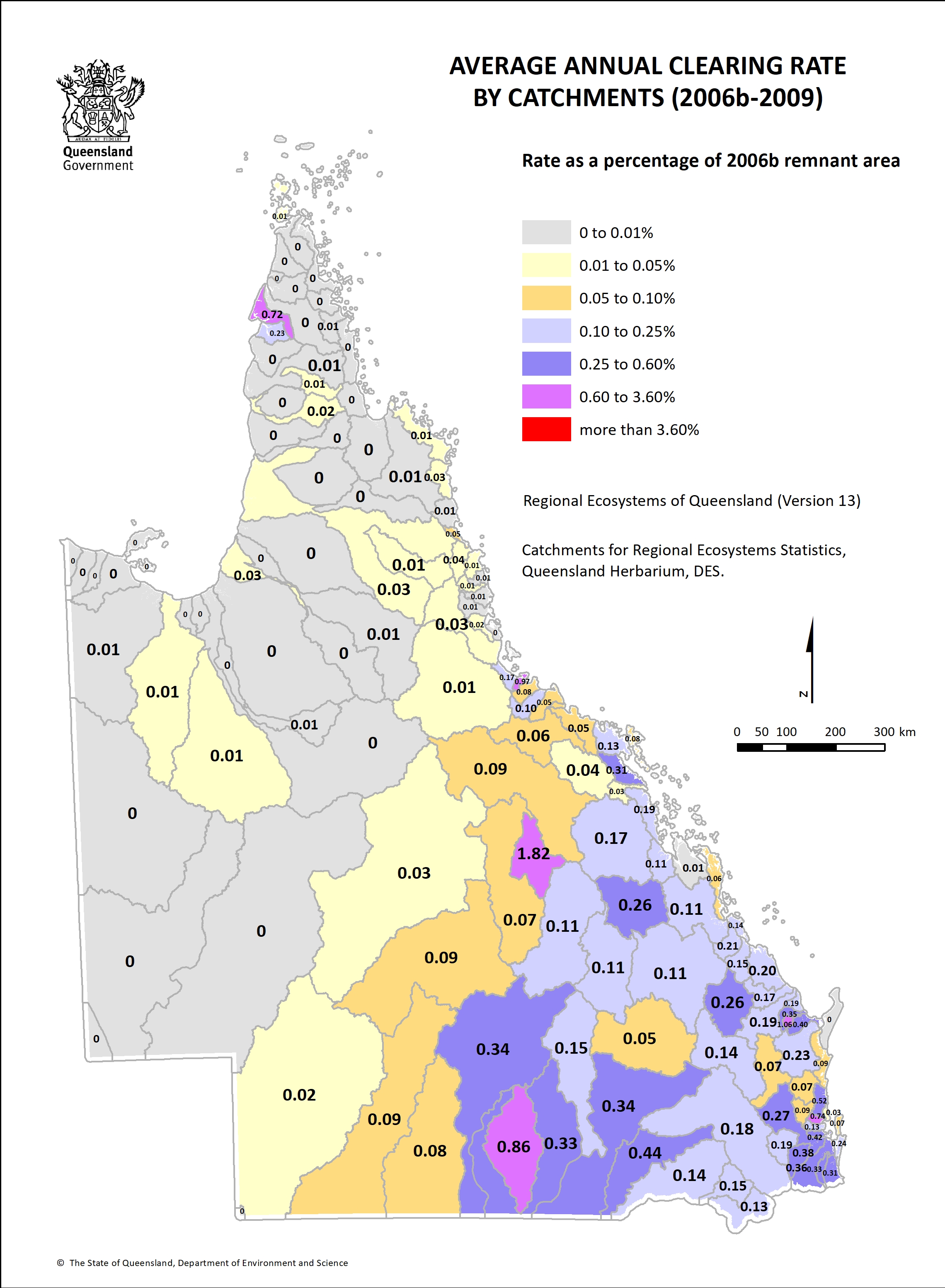
- Catchment clearing rate 2006b-09 1.3 MB)
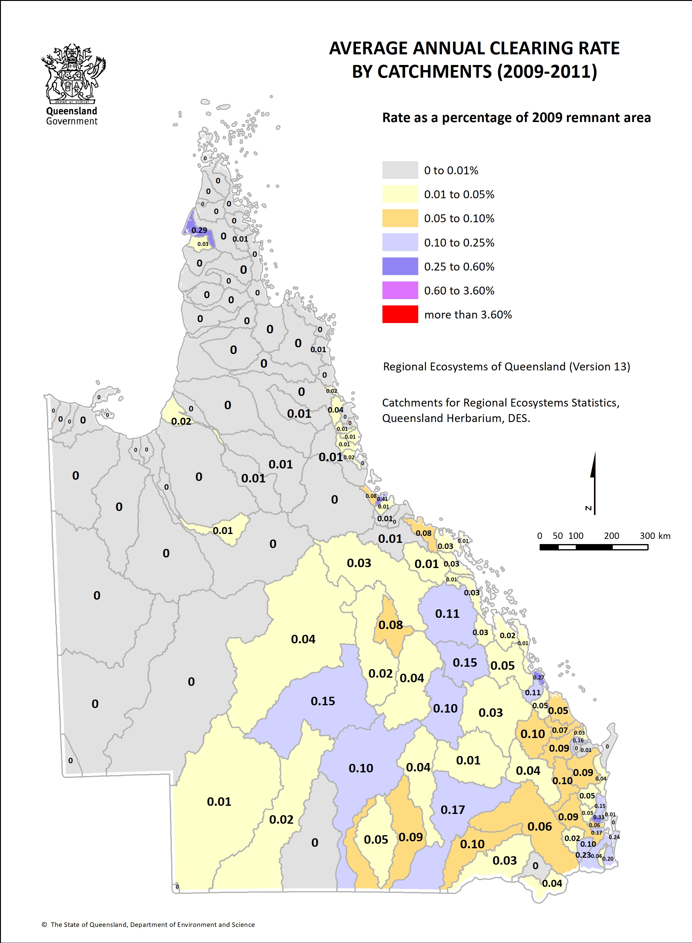
- Catchment clearing rate 2009-11 1.2 MB)
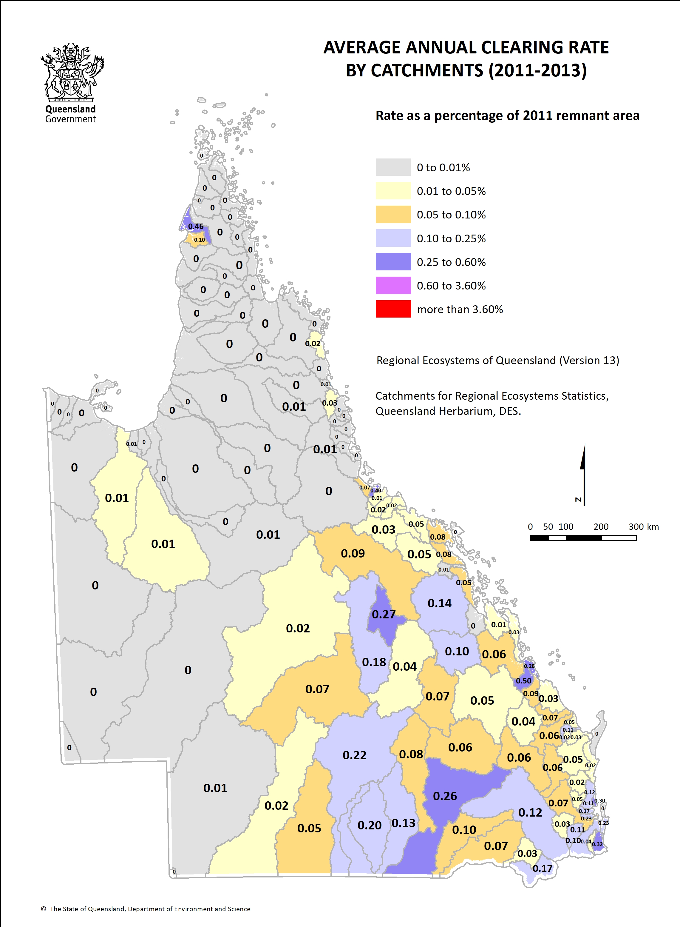
- Catchment clearing rate 2011-13 1.2 MB)
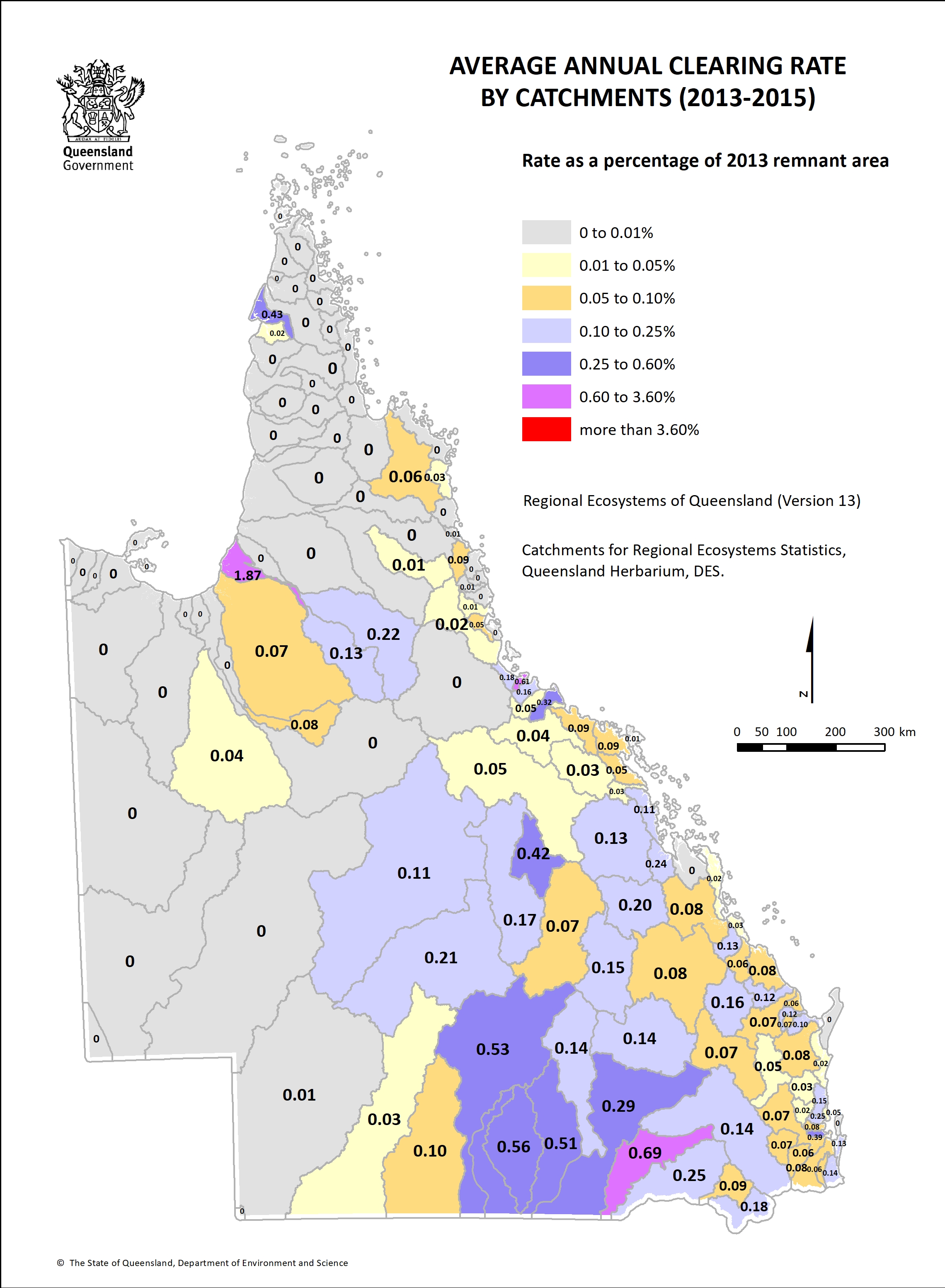
- Catchment clearing rate 2013-15 1.3 MB)
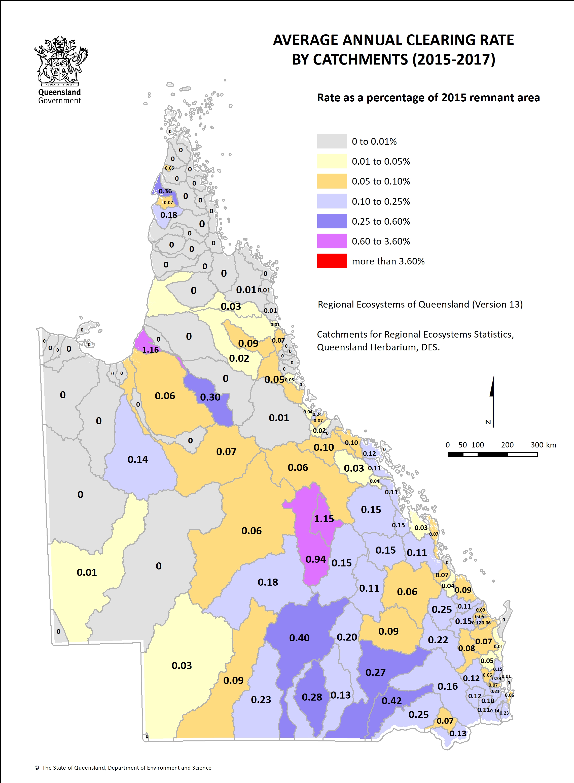
- Catchment clearing rate 2015-17 1.3 MB)
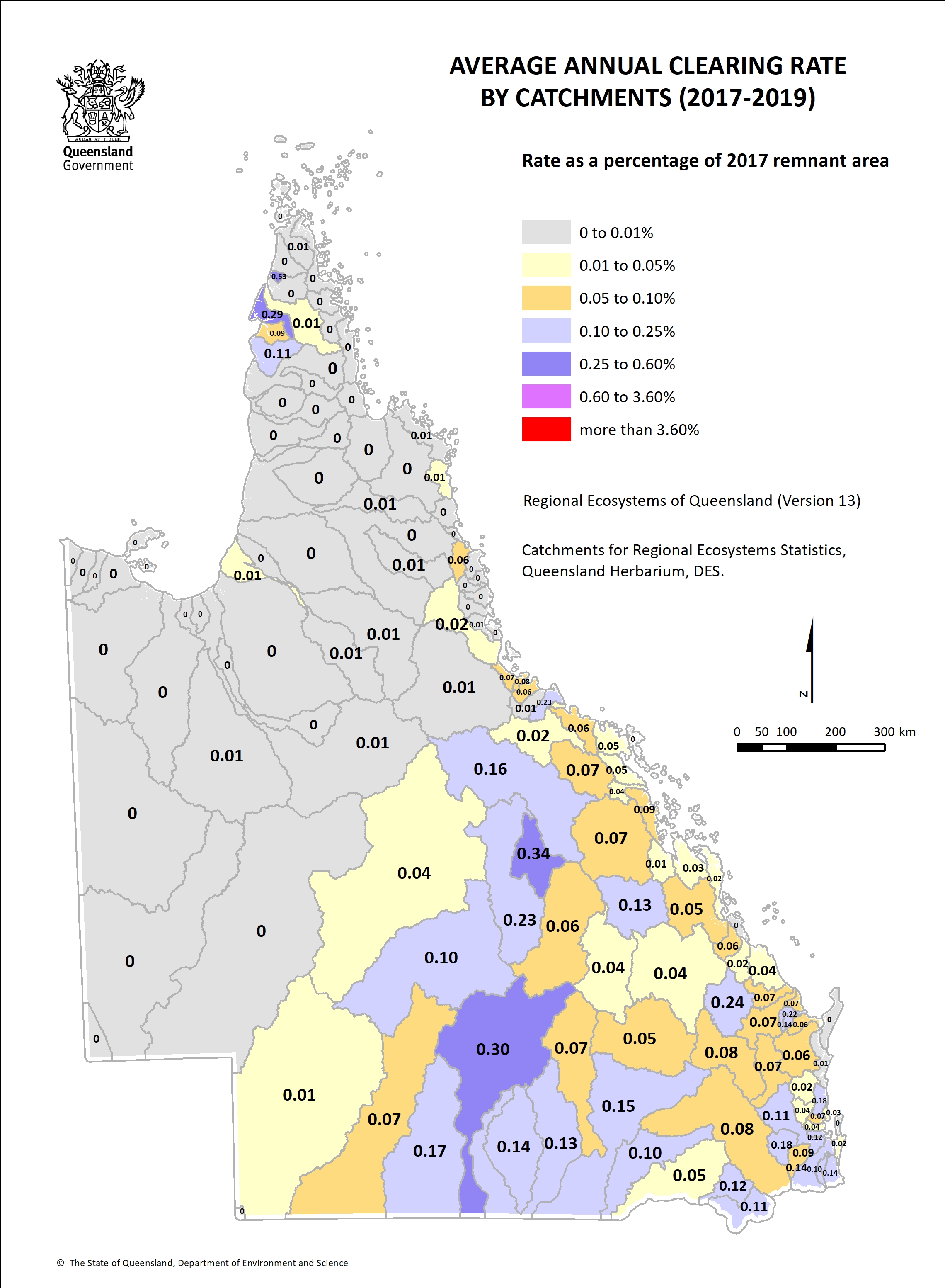
- Catchment clearing rate 2017-19 1.2 MB)
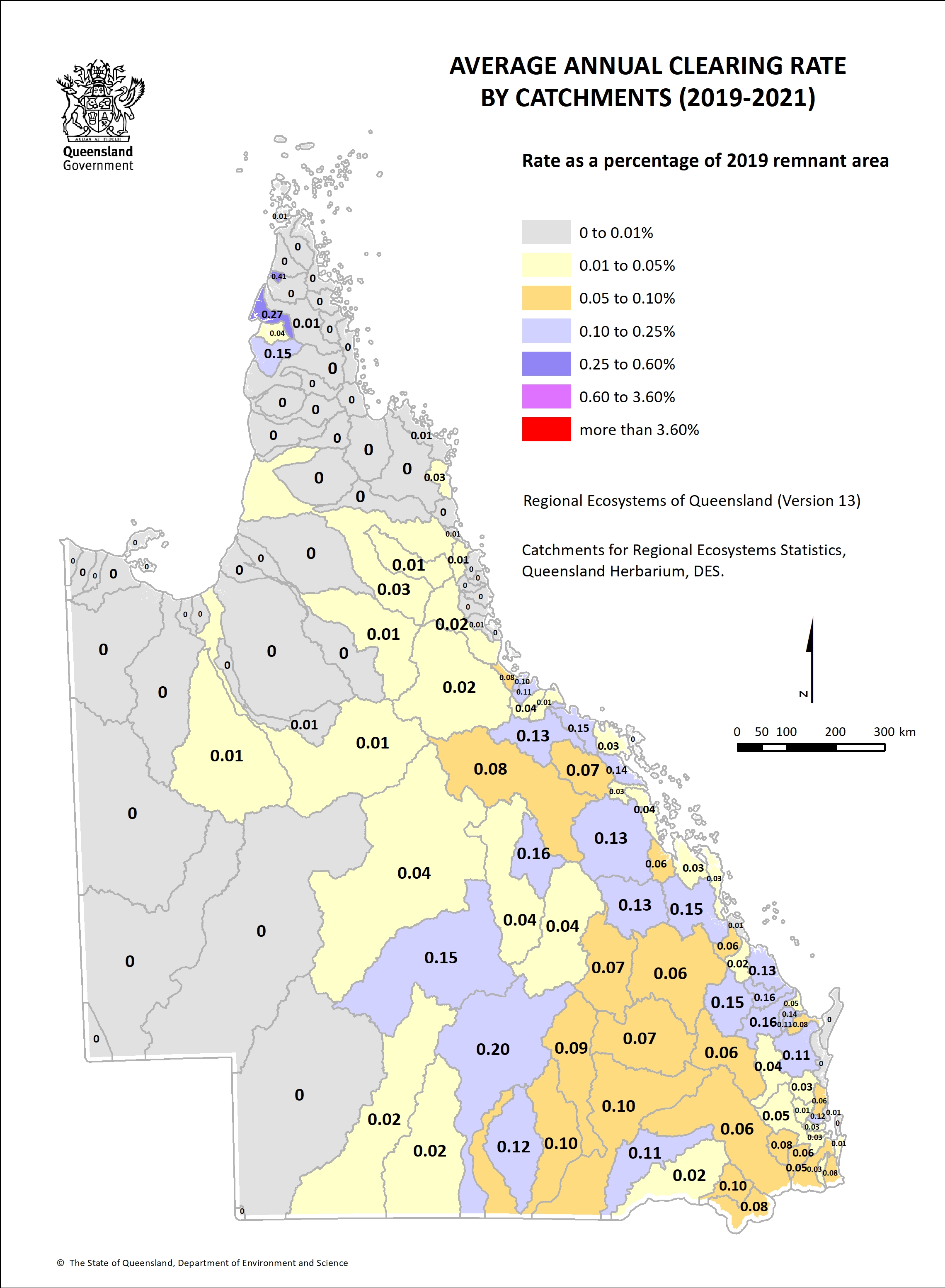
- Catchment clearing rate 2019-2021 1.3 MB)
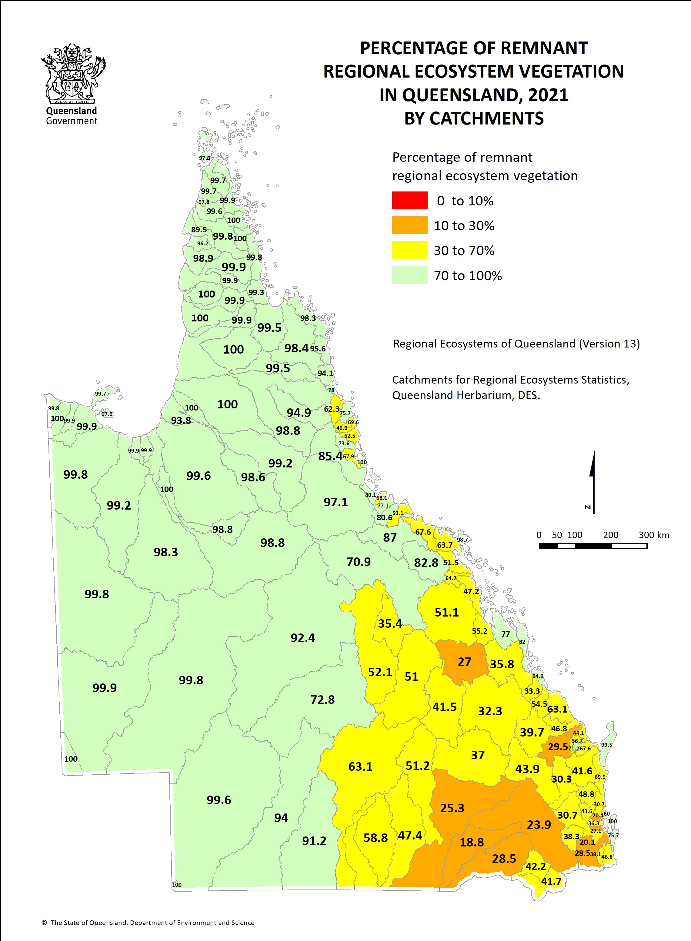
- Percentage of remnant vegetation by catchment 1.4 MB)
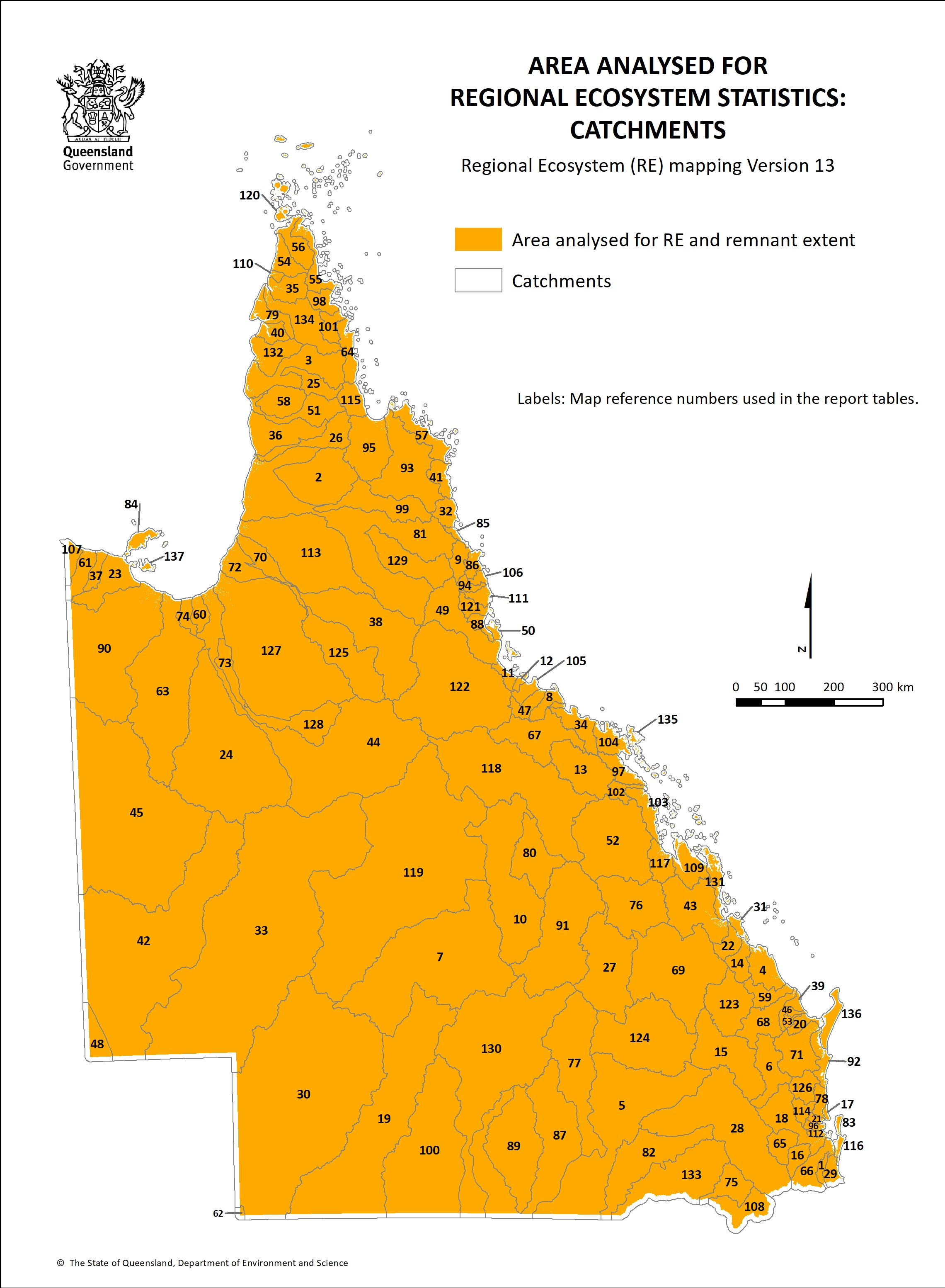
- Area analysed by catchment 1.3 MB)