Maps and statistical data by electoral district
Analyses of remnant regional ecosystems vegetation for the entire state by electoral boundaries between 1997 and 2021.
- Remnant vegetation cover by electoral district
- Regional ecosystems by electoral district
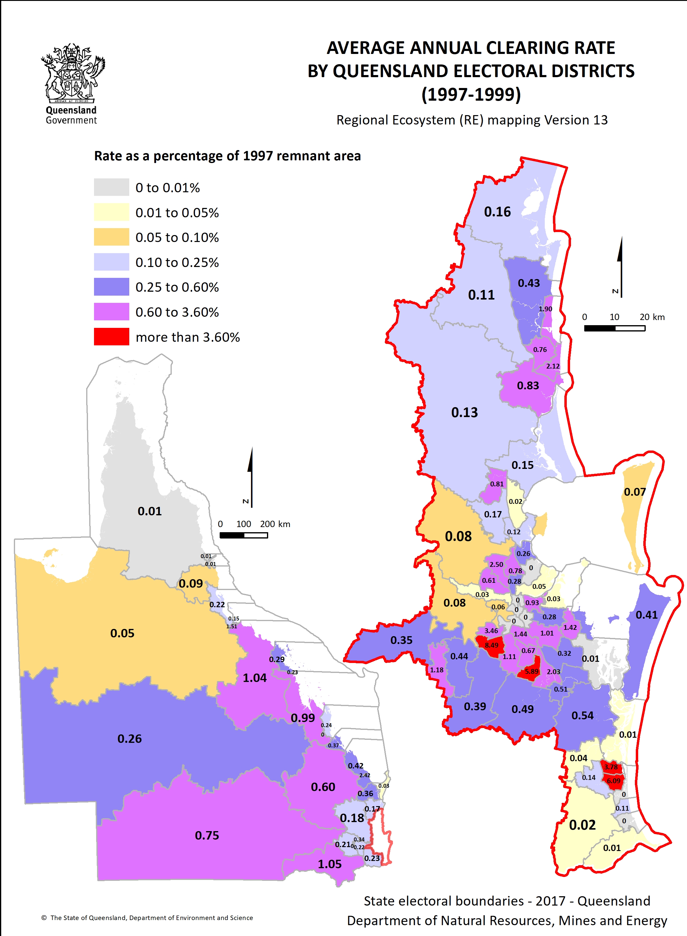
- Electoral district clearing rate 1997–1999 1.3 MB)
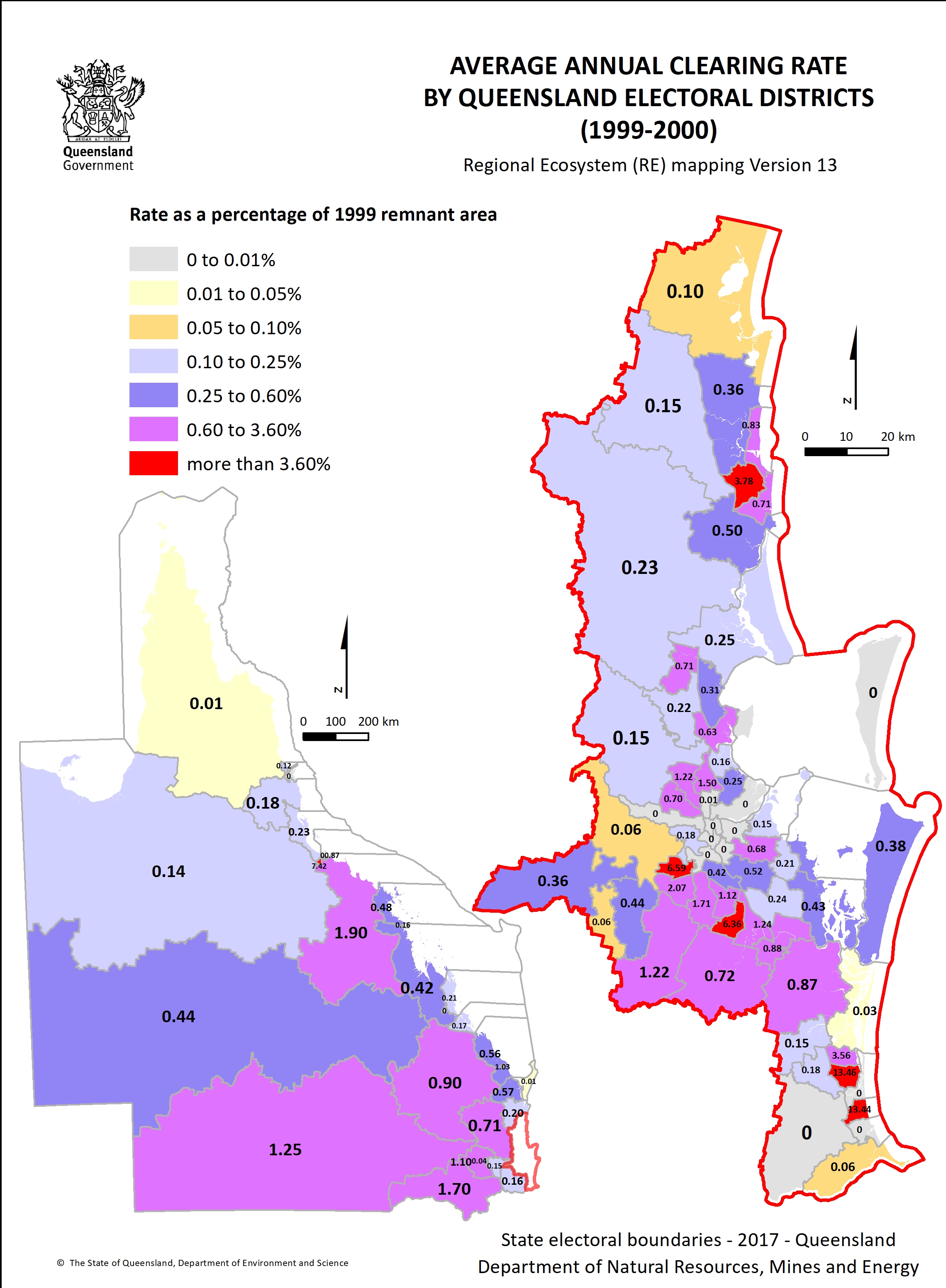
- Electoral district clearing rate 1999–2000 1.3 MB)
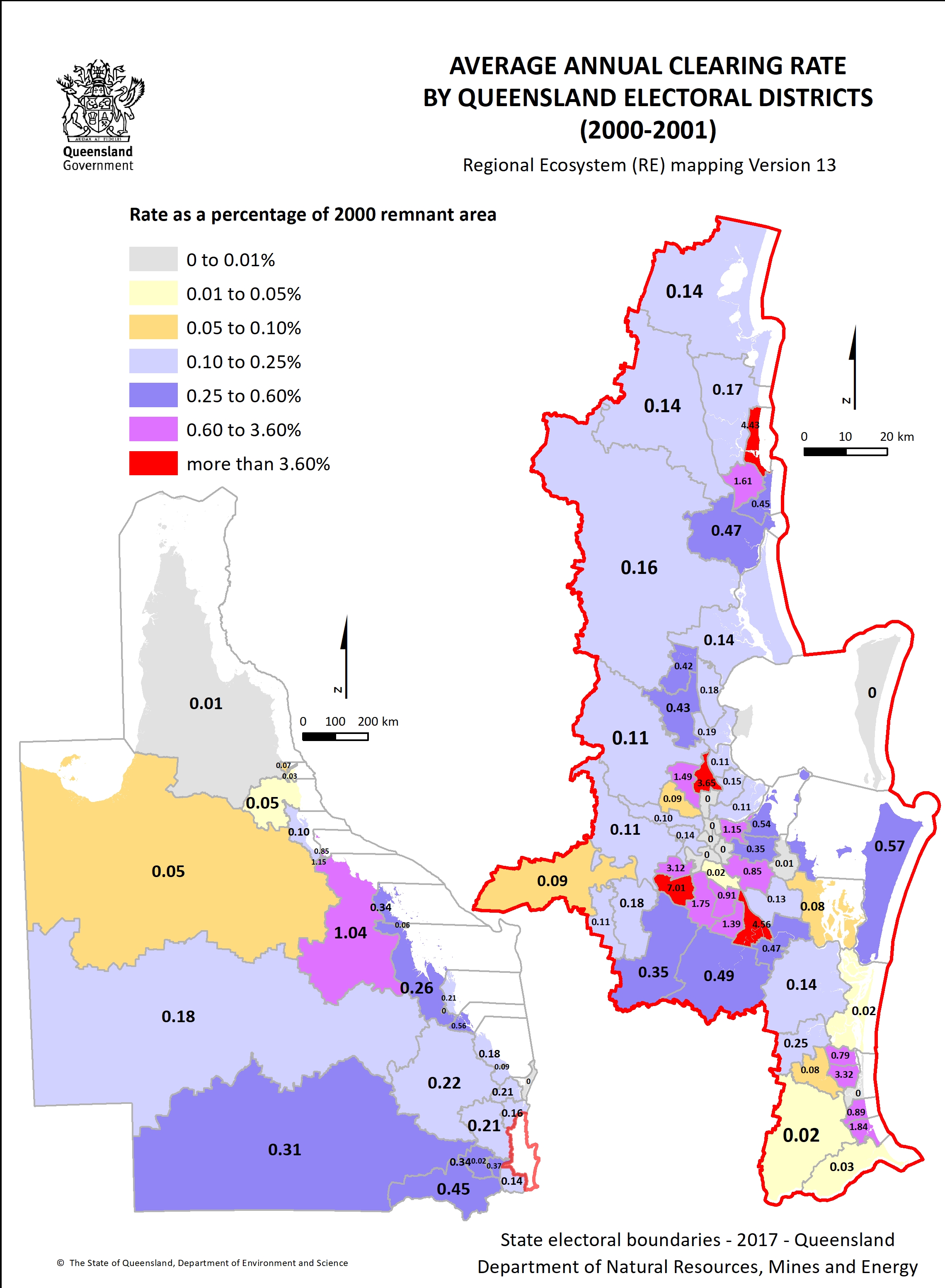
- Electoral district clearing rate 2000–2001 1.3 MB)
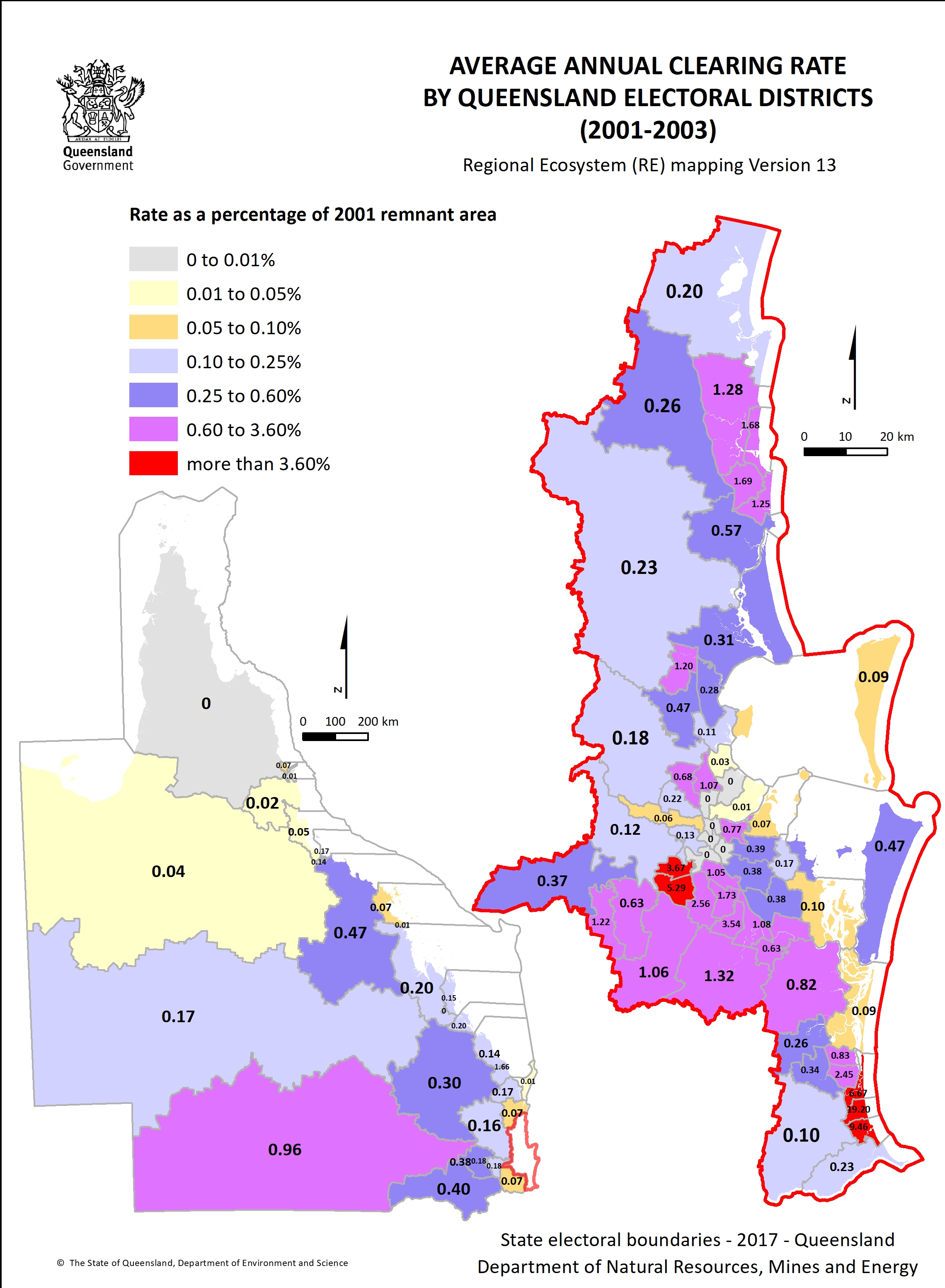
- Electoral district clearing rate 2001–2003 1.3 MB)
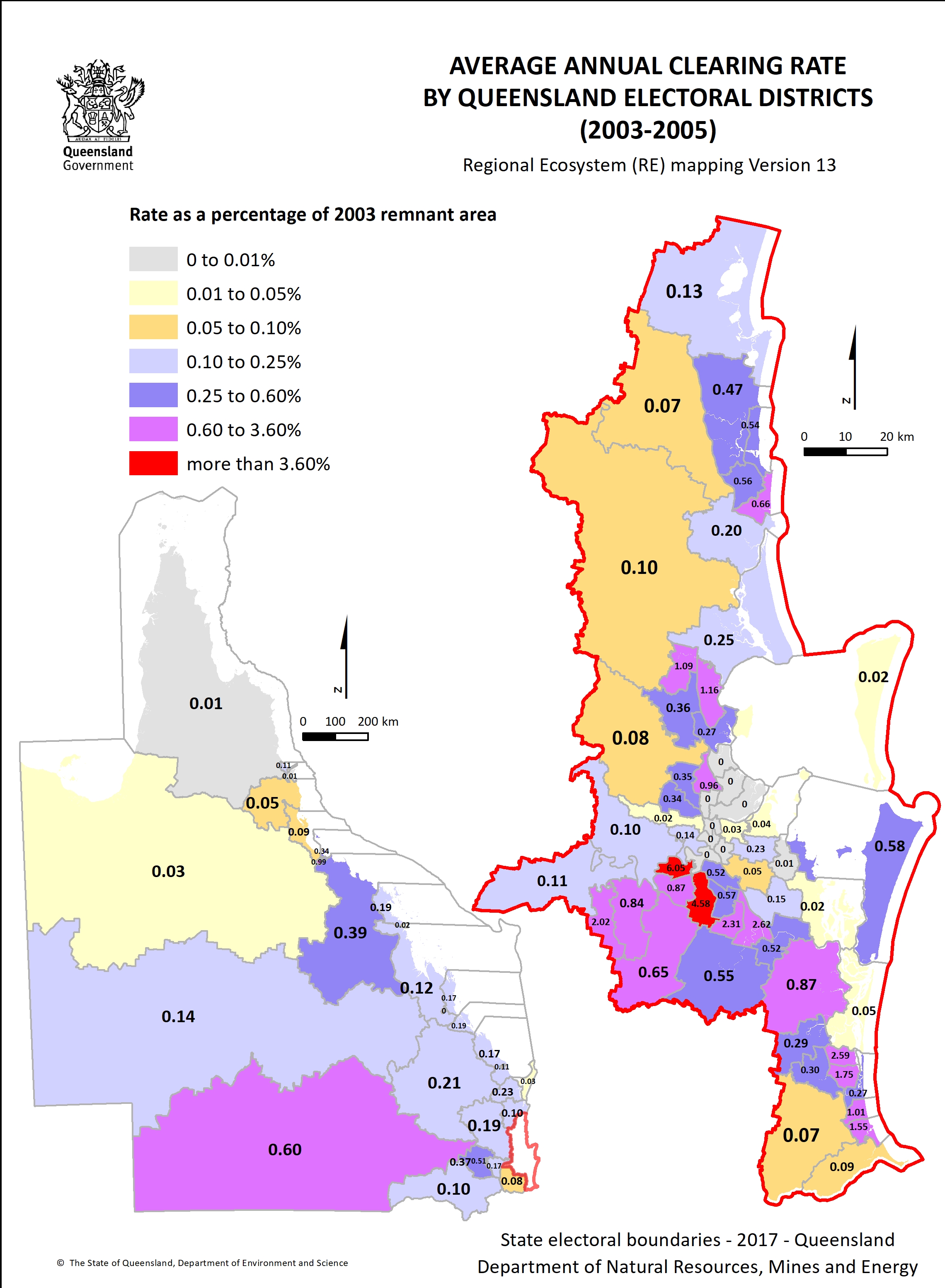
- Electoral district clearing rate 2003–2005 1.3 MB)
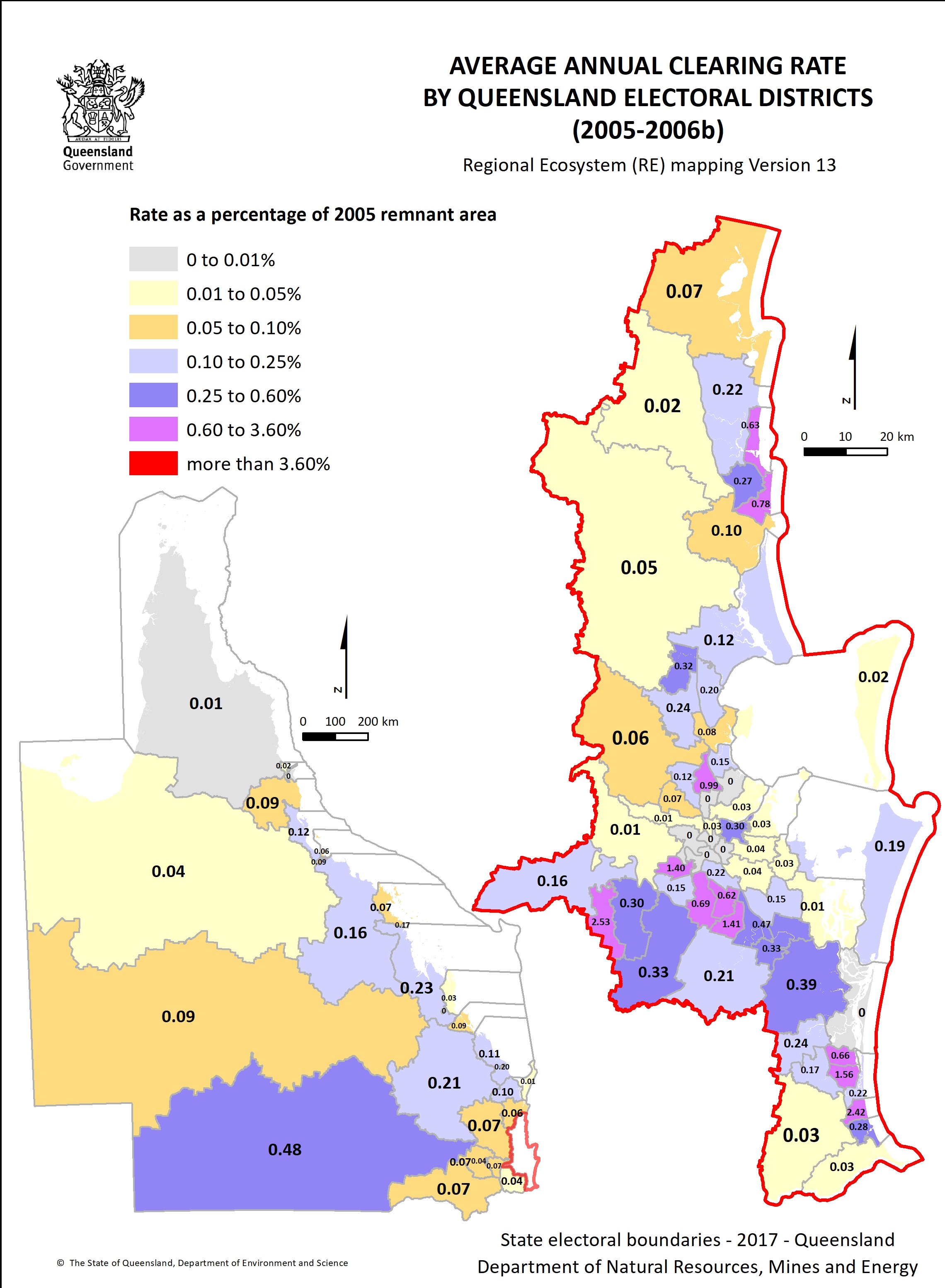
- Electoral district clearing rate 2005–2006B 1.3 MB)
- Electoral district clearing rate 2006B–2009 1.3 MB)
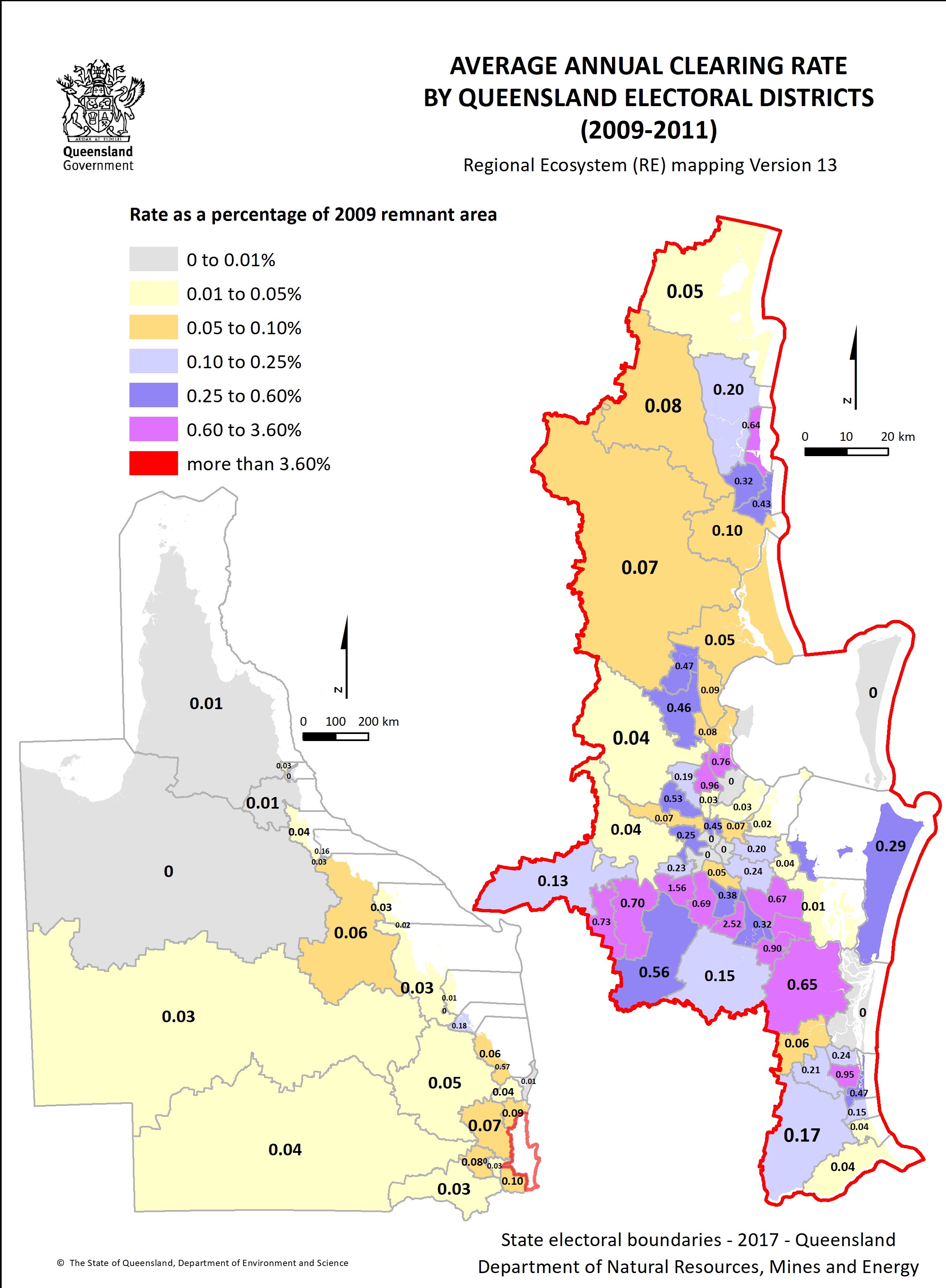
- Electoral district clearing rate 2009–2011 1.3 MB)
- Electoral district clearing rate 2011–2013 1.3 MB)
- Electoral district clearing rate 2013–2015 1.3 MB)
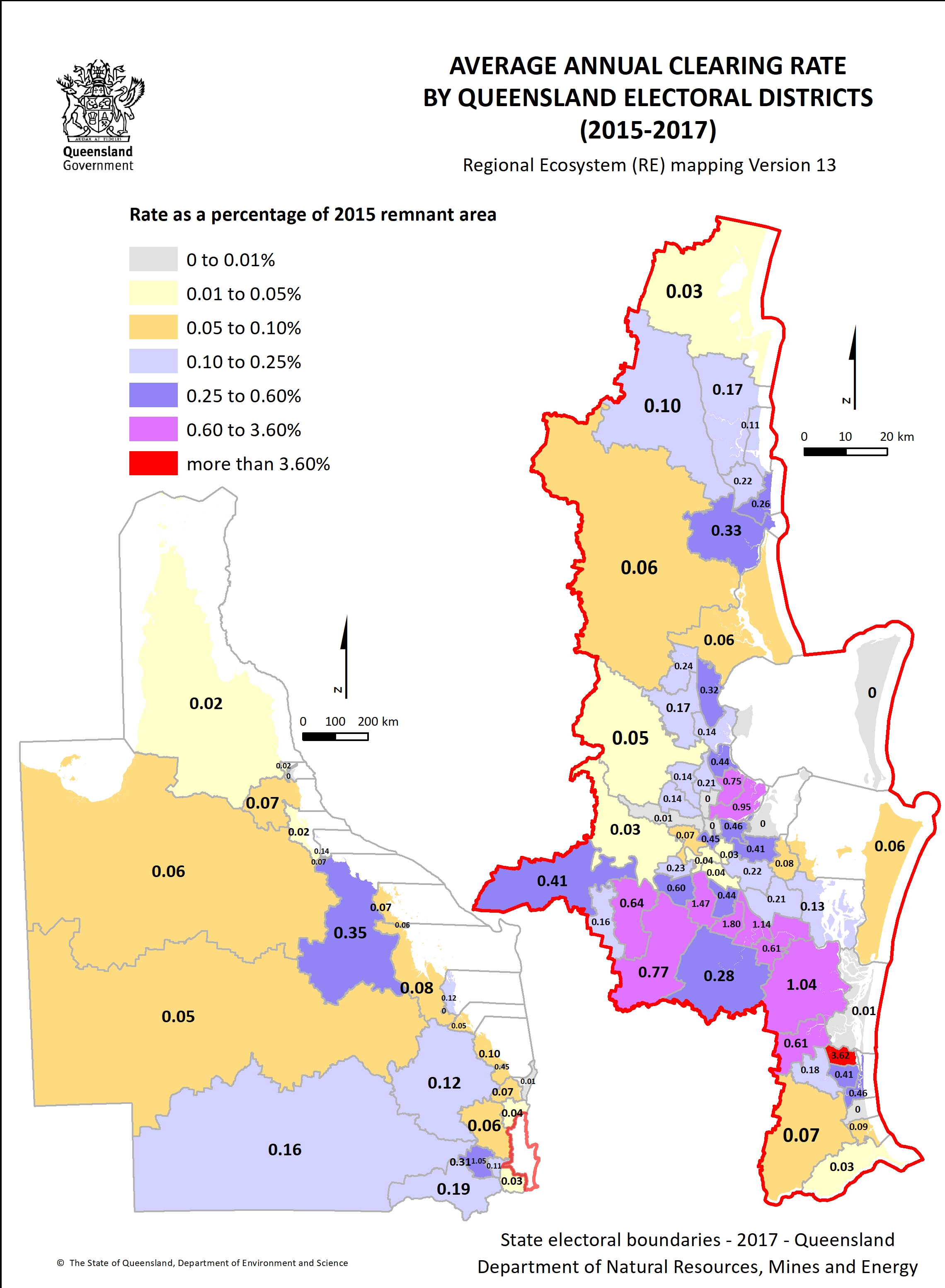
- Electoral district clearing rate 2015–2017 1.3 MB)
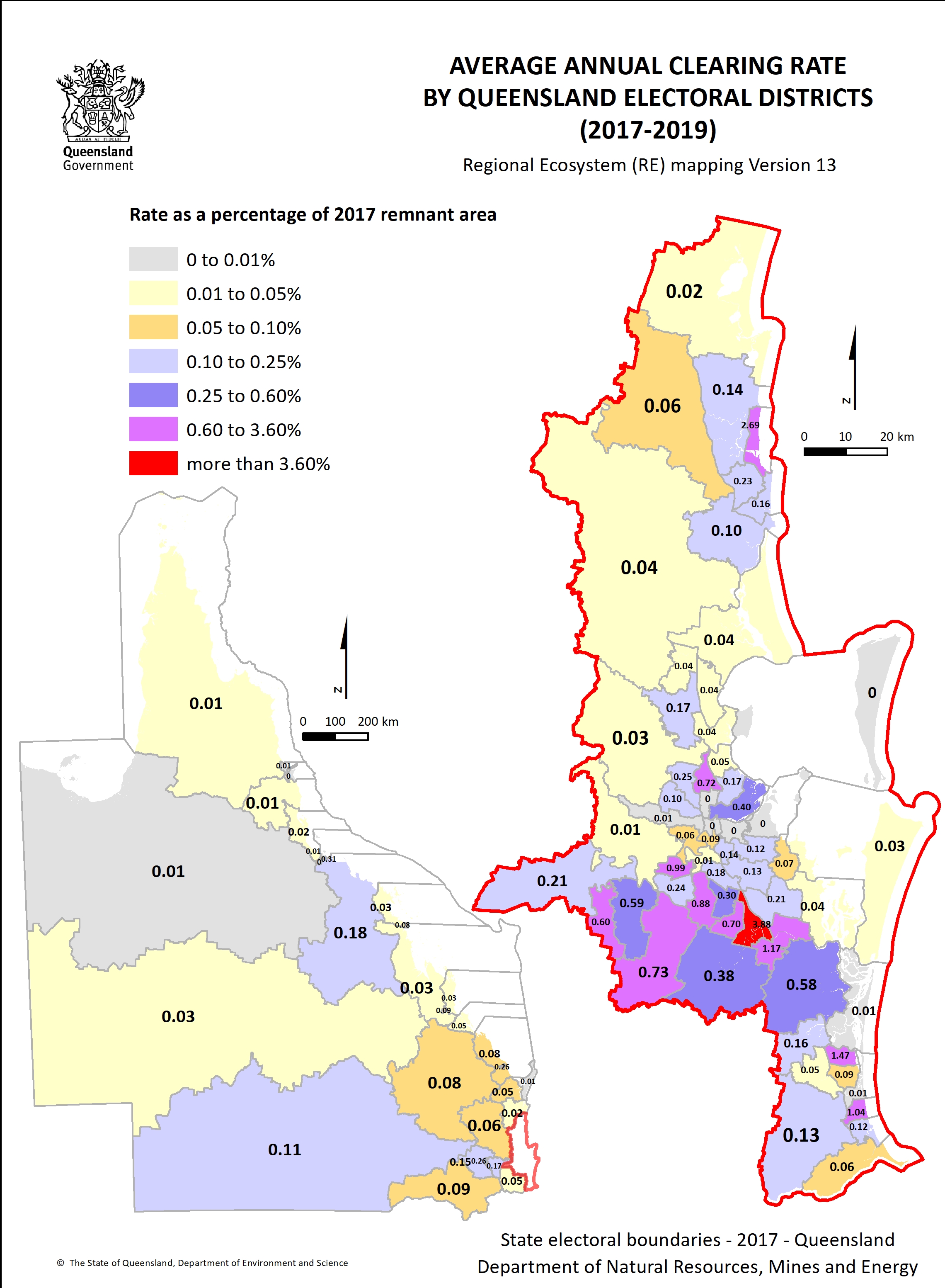
- Electoral district clearing rate 2017–2019 1.3 MB)
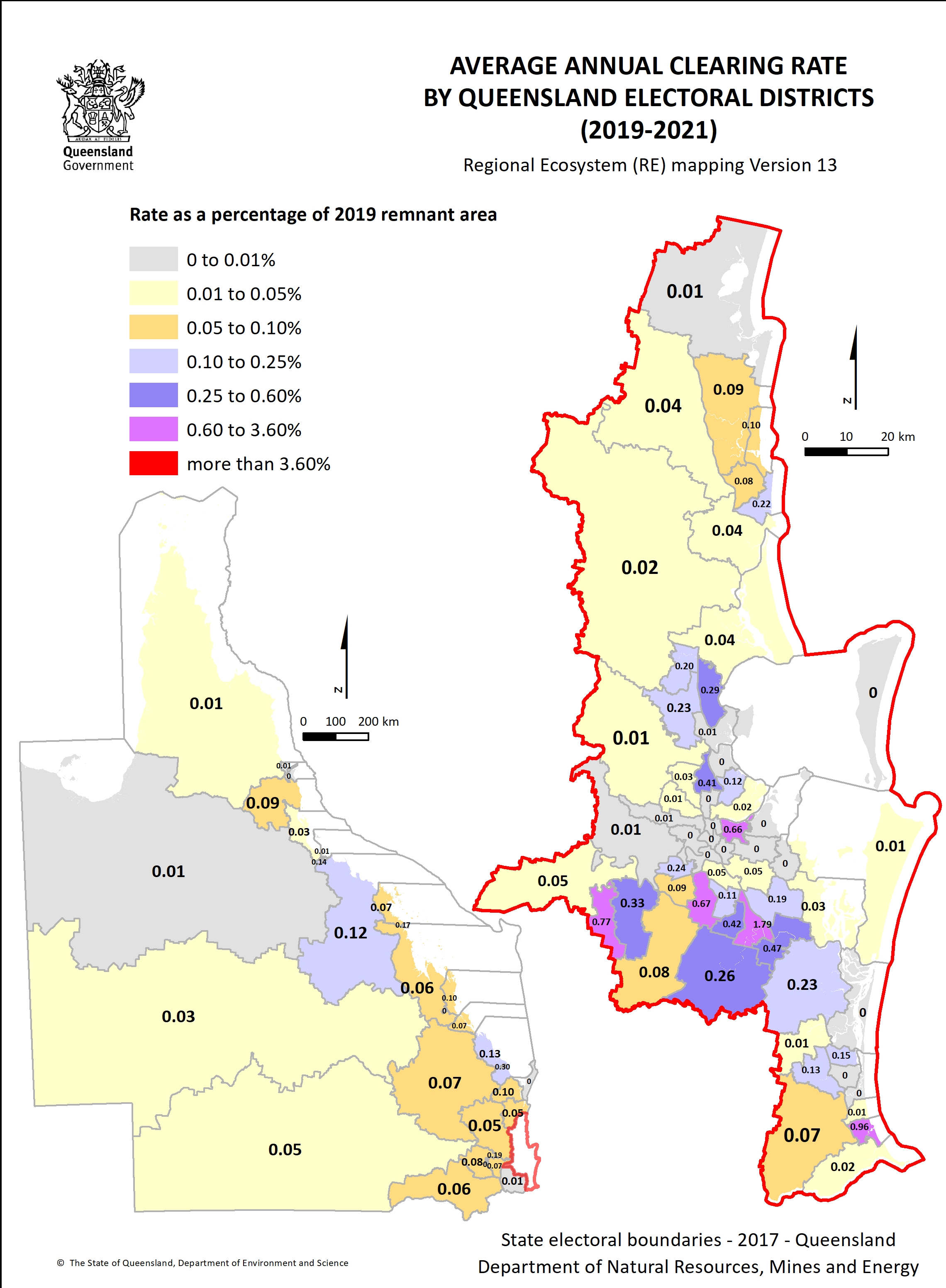
- Electoral district clearing rate 2019–2021 1.3 MB)
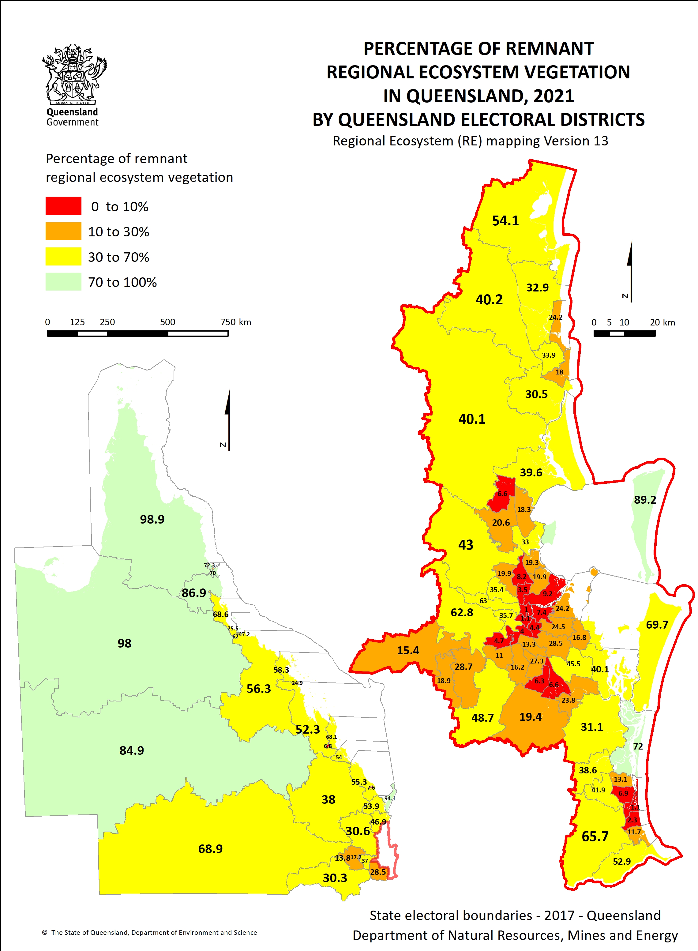
- Percentage of remnant vegetation by electoral district 1.4 MB)
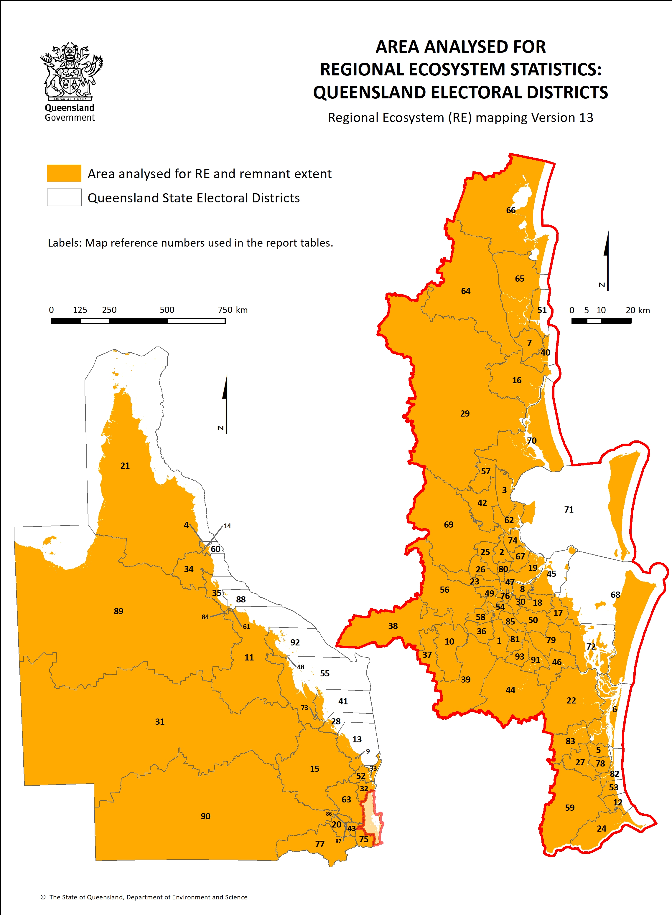
- Area analysed by electoral district 1.3 MB)